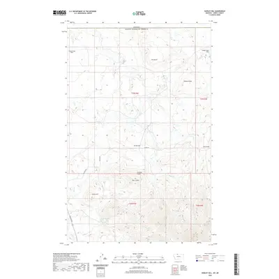
2020 Map of Hawley Hill
USGS Topo · Published 2020About this map
The Sweet Grass Hills rise prominently along the international border in northern Montana, defining the high-elevation landscape of this Liberty County quadrangle. The terrain is marked by dramatic drainages and peaks, including Ikes Buttel and Hawley Hill, which transition into deep erosional features like Simmons Coulee and Sears Coulee. This high-country geography dictates the local infrastructure, with ranch roads such as Whitlash Rd and Shaffer Rd skirting the bases of ridges like Bingham Ridge. A network of high-plains watercourses including Police Cr, Belle Cr, and Dohrs Cr flow through the foothills, while the unique 36n04e09cddb01 Spring provides a specific point of interest for those studying the hydrology of the northern borderlands. The map serves as a detailed record of the rugged topography where the American prairie meets the Canadian line.
Find a feature on this map
24 named features on this map. Tap any name to fly to it.
Don’t see what you’re looking for? This feature index may not catch every label — zoom into the map to look around manually.
Map Details
Editions of this 2020 Hawley Hill Map
This is the sole edition of this map. No revisions or reprints were ever made.
Other maps of this area

1954 · Shelby
USGS Topo · 1:250,000

1958 · Shelby
USGS Topo · 1:250,000
1962 · Bingham Lake
USGS Topo · 1:24,000

1962 · Whitlash
USGS Topo · 1:24,000
1962 · Hawley Hill
USGS Topo · 1:24,000

1962 · Haystack Butte
USGS Topo · 1:24,000

1962 · Mount Lebanon
USGS Topo · 1:24,000

1962 · Grassy Butte
USGS Topo · 1:24,000

1984 · Sweet Grass Hills
USGS Topo · 1:100,000
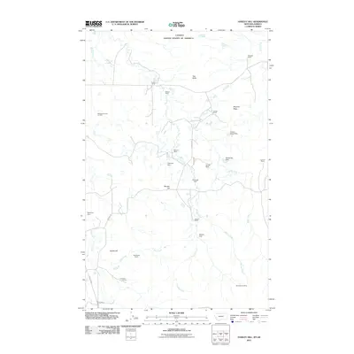
2011 · Hawley Hill
USGS Topo · 1:24,000