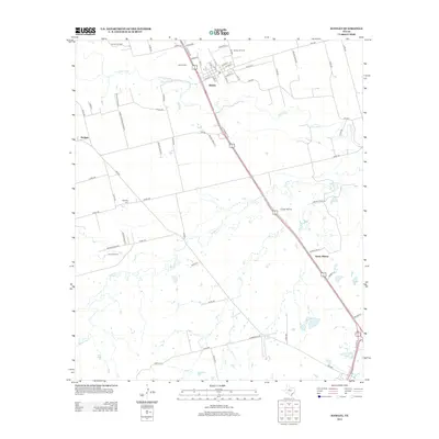
2012 Map of Hawley
USGS Topo · Published 2012About this map
Hawley sits at the northern end of a productive corridor where agricultural land meets the industrial demands of the West Texas energy sector. The landscape is defined by the winding course of the Clear Fork and Mulberry Cr, while the subterranean economy is evidenced by the Dorsey Oil Field, Hawley Oil Field, and Akard Oil Field. These fields, alongside the Cosden Refinery, represent the region's long-standing reliance on petroleum extraction. Local history and genealogy are preserved at the Hawley Cem and Mid Way Cem, which serve as quiet landmarks among the rural road network including FM-1226 and FM-1082. To the south, the expansion of North Abilene signals the urban growth pushing toward these smaller ranching and oil communities, such as Hodges, showing a region in transition during the early 21st century.
Find a feature on this map
70 named features on this map. Tap any name to fly to it.
Don’t see what you’re looking for? This feature index may not catch every label — zoom into the map to look around manually.
Map Details
Editions of this 2012 Hawley Map
This is the sole edition of this map. No revisions or reprints were ever made.
Other maps of this area

1890 · Abilene
USGS Topo · 1:125,000

1891 · Anson
USGS Topo · 1:125,000

1892 · Abilene
USGS Topo · 1:125,000

1893 · Anson
USGS Topo · 1:125,000

1954 · Abilene
USGS Topo · 1:250,000

1957 · Hawley
USGS Topo · 1:62,500

1957 · Kirby Lake
USGS Topo · 1:62,500

1957 · Abilene West
USGS Topo · 1:24,000

1957 · Abilene East
USGS Topo · 1:24,000

1957 · Nugent
USGS Topo · 1:62,500