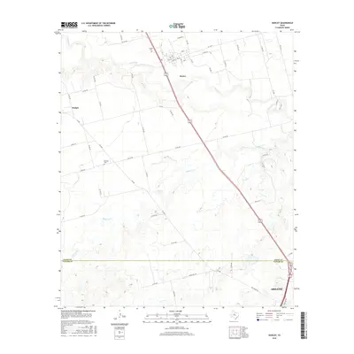
2016 Map of Hawley
USGS Topo · Published 2016About this map
The Clear Fork and Mulberry Cr dominate this rural landscape in the 2010s, cutting through the terrain between the communities of Hawley and Hodges. The map provides a detailed look at the northern outskirts of Abilene, where the Jones County and Taylor County line divides the agricultural and residential outskirts. Local history and family ties are anchored by established sites like Hawley Cem and Mid Way Cem, while a dense network of farm-to-market roads and county routes, such as FM 605, FM 707, and Co RD 509, reveal the modern infrastructure supporting this Texas prairie region. The grid of streets within Hawley, including Ave G and 12th St, highlights the town's small-town layout just west of the major transportation corridors.
Find a feature on this map
55 named features on this map. Tap any name to fly to it.
Don’t see what you’re looking for? This feature index may not catch every label — zoom into the map to look around manually.
Map Details
Editions of this 2016 Hawley Map
This is the sole edition of this map. No revisions or reprints were ever made.
Other maps of this area

1890 · Abilene
USGS Topo · 1:125,000

1891 · Anson
USGS Topo · 1:125,000

1892 · Abilene
USGS Topo · 1:125,000

1893 · Anson
USGS Topo · 1:125,000

1954 · Abilene
USGS Topo · 1:250,000

1957 · Hawley
USGS Topo · 1:62,500

1957 · Kirby Lake
USGS Topo · 1:62,500

1957 · Abilene West
USGS Topo · 1:24,000

1957 · Abilene East
USGS Topo · 1:24,000

1957 · Nugent
USGS Topo · 1:62,500