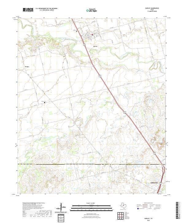
2022 Map of Hawley
USGS Topo · Published 2022About this map
Hawley serves as the primary hub of this landscape, situated just north of the Jones and Taylor county line. The settlement's residential grid is defined by streets like Ave G and 1st St, with the Hawley Cem located on the northwestern periphery. The geography is characterized by the winding path of the Clear Fork Brazos River, which snakes across the northern portion of the sheet, and its tributary, Mulberry Cr, which drains the southern ranchlands. Further south, the map captures the northern edge of Abilene, where urban development begins to interface with the rural county border. For those tracking local history, Midway Cem and the small community of Hodges provide key points of reference within a network of farm-to-market roads like FM 3326 and FM 707 that connect these dispersed agricultural areas.
Find a feature on this map
55 named features on this map. Tap any name to fly to it.
Don’t see what you’re looking for? This feature index may not catch every label — zoom into the map to look around manually.
Map Details
Editions of this 2022 Hawley Map
This is the sole edition of this map. No revisions or reprints were ever made.
Other maps of this area

1890 · Abilene
USGS Topo · 1:125,000

1891 · Anson
USGS Topo · 1:125,000

1892 · Abilene
USGS Topo · 1:125,000

1893 · Anson
USGS Topo · 1:125,000

1954 · Abilene
USGS Topo · 1:250,000

1957 · Hawley
USGS Topo · 1:62,500

1957 · Kirby Lake
USGS Topo · 1:62,500

1957 · Abilene West
USGS Topo · 1:24,000

1957 · Abilene East
USGS Topo · 1:24,000

1957 · Nugent
USGS Topo · 1:62,500