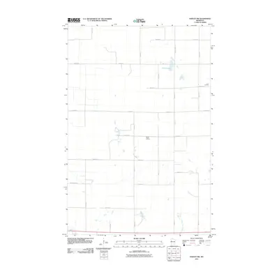
2010 Map of Hawley NW
USGS Topo · Published 2010About this map
Spring Prairie Cemetery and Lysne Cemetery stand as quiet landmarks within this rural Clay County landscape, captured during the 2010 survey. The terrain is defined by a rigorous grid of section-line roads, including 150th St N and 80th Ave N, reflecting the deeply ingrained township-and-range system of the Red River Valley region. Hatchet Lake provides a natural break in the otherwise systematic agricultural layout of the northwestern portion of the sheet. The prevalence of these section roads, such as 200th St N and 57th Ave N, suggests a landscape dominated by large-scale farming and sparse homesteads, where local transit is facilitated by routes like County Hwy 113. This map provides genealogists and local historians with a precise look at the placement of family burial grounds and the connectivity of the rural road network at the turn of the decade.
Find a feature on this map
20 named features on this map. Tap any name to fly to it.
Don’t see what you’re looking for? This feature index may not catch every label — zoom into the map to look around manually.
Map Details
Editions of this 2010 Hawley NW Map
This is the sole edition of this map. No revisions or reprints were ever made.
Other maps of this area

1895 · Fargo
USGS Topo · 1:125,000

1897 · Fargo
USGS Topo · 1:125,000

1918 · Ulen
USGS Topo · 1:62,500

1919 · Hawley
USGS Topo · 1:62,500

1952 · Grand Forks
USGS Topo · 1:250,000

1953 · Fargo
USGS Topo · 1:250,000

1956 · Fargo
USGS Topo · 1:250,000

1956 · Grand Forks
USGS Topo · 1:250,000
1964 · Glyndon South
USGS Topo · 1:24,000
1964 · Glyndon North
USGS Topo · 1:24,000