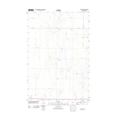
2013 Map of Hawley NW
USGS Topo · Published 2013About this map
Spring Prairie Cem and Lysne Cem anchor this section of Clay County, documenting the local heritage of the rural Red River Valley region. The landscape is defined by the winding course of the Buffalo River in the southwest corner and the presence of Hatchet Lake to the north. A structured grid of section roads, including 150th St N and 170th St N, organizes the agricultural terrain, while Us-10 provides the primary east-west corridor across the southern edge of the quadrangle. This map reflects a stable agricultural layout, where family history and land use are etched into the landscape through small community cemeteries and established farm-to-market roads.
Find a feature on this map
19 named features on this map. Tap any name to fly to it.
Don’t see what you’re looking for? This feature index may not catch every label — zoom into the map to look around manually.
Map Details
Editions of this 2013 Hawley NW Map
This is the sole edition of this map. No revisions or reprints were ever made.
Other maps of this area

1895 · Fargo
USGS Topo · 1:125,000

1897 · Fargo
USGS Topo · 1:125,000

1918 · Ulen
USGS Topo · 1:62,500

1919 · Hawley
USGS Topo · 1:62,500

1952 · Grand Forks
USGS Topo · 1:250,000

1953 · Fargo
USGS Topo · 1:250,000

1956 · Fargo
USGS Topo · 1:250,000

1956 · Grand Forks
USGS Topo · 1:250,000
1964 · Glyndon South
USGS Topo · 1:24,000
1964 · Glyndon North
USGS Topo · 1:24,000