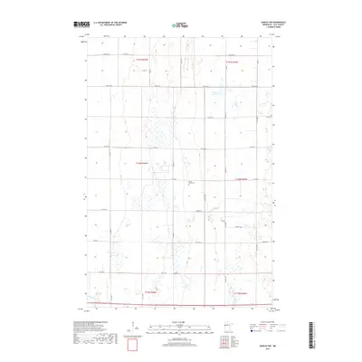
2019 Map of Hawley NW
USGS Topo · Published 2019About this map
The flat glacial plains of Clay County are defined by a meticulous grid of rural section lines and township boundaries, including t140n r46w and t140n r45w. In this predominantly agricultural landscape, small historical sites like Spring Prairie Cem and Lysne Cem stand as markers of the early Scandinavian and settler families who established homesteads across these prairies. The terrain is characterized by numerous small wetlands and basins, with Hatchet Lake being the most prominent water body in the northern section of the survey. Essential county routes such as Co Rd 86 and Co Rd 87 provide the primary infrastructure connecting these remote farmsteads and agricultural plots, reflecting a settlement pattern that has remained largely unchanged in its spatial organization over several decades.
Find a feature on this map
33 named features on this map. Tap any name to fly to it.
Don’t see what you’re looking for? This feature index may not catch every label — zoom into the map to look around manually.
Map Details
Editions of this 2019 Hawley NW Map
This is the sole edition of this map. No revisions or reprints were ever made.
Other maps of this area

1895 · Fargo
USGS Topo · 1:125,000

1897 · Fargo
USGS Topo · 1:125,000

1918 · Ulen
USGS Topo · 1:62,500

1919 · Hawley
USGS Topo · 1:62,500

1952 · Grand Forks
USGS Topo · 1:250,000

1953 · Fargo
USGS Topo · 1:250,000

1956 · Fargo
USGS Topo · 1:250,000

1956 · Grand Forks
USGS Topo · 1:250,000
1964 · Glyndon South
USGS Topo · 1:24,000
1964 · Glyndon North
USGS Topo · 1:24,000