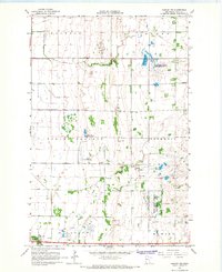
1966 Map of Hawley NW
USGS Topo · Published 1967About this map
Spring Prairie and Cromwell townships define this mid-1960s landscape, where an intricate network of drainage systems like County Ditch No 39 and County Ditch No 26 reveals the intensive agricultural modification of the Red River Valley. The terrain is marked by numerous Gravel Pits, pointing to the region's glacial history and local industry during this period of infrastructure development. Conservation areas are prominent, including the Jeral State Wildlife Management Area near Hatchet Lake and the Gruhl State Wildlife Management Area further south. Genealogists can locate family landmarks such as the Lysne Cem and Spring Prairie Cem. The southern edge of the survey is bounded by the Buffalo River as it meanders through Riverton and Hawley townships, while a long-distance Pipeline cuts across the northeastern sections, reflecting the era's energy expansion.
Find a feature on this map
19 named features on this map. Tap any name to fly to it.
Don’t see what you’re looking for? This feature index may not catch every label — zoom into the map to look around manually.
Map Details
Editions of this 1966 Hawley NW Map
2 editions found
Other maps of this area

1895 · Fargo
USGS Topo · 1:125,000

1897 · Fargo
USGS Topo · 1:125,000

1918 · Ulen
USGS Topo · 1:62,500

1919 · Hawley
USGS Topo · 1:62,500

1952 · Grand Forks
USGS Topo · 1:250,000

1953 · Fargo
USGS Topo · 1:250,000

1956 · Fargo
USGS Topo · 1:250,000

1956 · Grand Forks
USGS Topo · 1:250,000
1964 · Glyndon South
USGS Topo · 1:24,000
1964 · Glyndon North
USGS Topo · 1:24,000