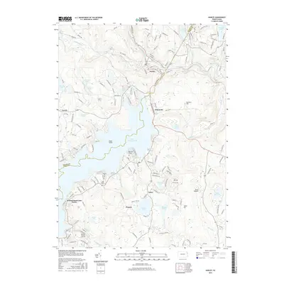
2016 Map of Hawley
USGS Topo · Published 2016About this map
Lake Wallenpaupack dominates this landscape on the border of Wayne and Pike counties, where its sprawling shoreline shapes the modern residential and recreational layout of the region. The settlement of Hawley sits at the confluence of Middle Creek and the Lackawaxen River, serving as a historic hub north of the dam. To the south, the map reveals a transition from these primary waterways into a network of smaller lakes and ponds, such as Fairview Lake and Tinkwig Lake, interspersed with established communities like Paupack and Tafton. Genealogists and local historians will find several burial grounds noted, including Paupack Cem and Pine Grove Cem, located near the southeastern reaches of the reservoir. The presence of the Mountain Bay Air Park Inc and numerous planned residential developments like Wallenpaupack Lake Estates reflects the area's twentieth-century evolution into a significant destination for seasonal and year-round lakeside living.
Find a feature on this map
143 named features on this map. Tap any name to fly to it.
Don’t see what you’re looking for? This feature index may not catch every label — zoom into the map to look around manually.
Map Details
Editions of this 2016 Hawley Map
This is the sole edition of this map. No revisions or reprints were ever made.
Other maps of this area

1892 · Honesdale
USGS Topo · 1:62,500

1920 · Damascus
USGS Topo · 1:62,500

1923 · Damascus
USGS Topo · 1:62,500

1928 · Ariel
USGS Topo · 1:62,500

1932 · Ariel
USGS Topo · 1:62,500

1935 · Hawley
USGS Topo · 1:62,500

1938 · Hawley
USGS Topo · 1:62,500

1943 · Honesdale
USGS Topo · 1:125,000

1944 · Damascus
USGS Topo · 1:62,500

1946 · Honesdale
USGS Topo · 1:24,000
Featured Places
- Lackawaxen Township, PA
- Blooming Grove Township, PA
- Hawley, PA
- Palmyra Township, PA
- Palmyra Township, PA