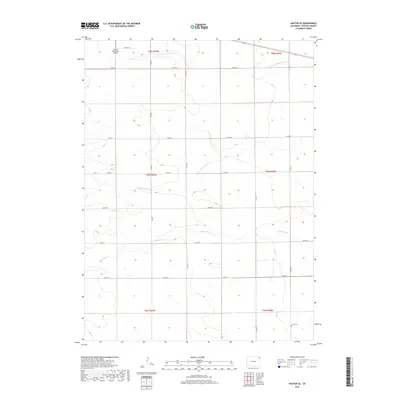
2019 Map of Haxtun SE
USGS Topo · Published 2019About this map
N Fork Frenchman Cr and S Fork Frenchman Cr define the hydrological character of this portion of Phillips County, where seasonal drainage patterns across the High Plains have historically dictated land use and transportation. The landscape is organized by a strict section-line road grid, including Co RD 26 and Co RD 14, which serves the agricultural operations between the forks of the creek. In the southeast corner, the Jarvis Cem stands as a primary genealogical landmark for local family research. The northwestern edge of the sheet includes the Haxtun Municipal Airport, signaling the modern infrastructure that supports this rural corridor. Further south, Sandy Creek meanders through the township, illustrating the varied subtle terrain that characterizes the region's eastern plains.
Find a feature on this map
23 named features on this map. Tap any name to fly to it.
Don’t see what you’re looking for? This feature index may not catch every label — zoom into the map to look around manually.
Map Details
Editions of this 2019 Haxtun SE Map
This is the sole edition of this map. No revisions or reprints were ever made.
Other maps of this area

1954 · Sterling
USGS Topo · 1:250,000

1958 · Sterling
USGS Topo · 1:250,000

1962 · Haxtun East
USGS Topo · 1:24,000

1962 · Haxtun West
USGS Topo · 1:24,000

1962 · Holyoke NW
USGS Topo · 1:24,000

1971 · Paoli
USGS Topo · 1:24,000

1971 · Fiddler Peak
USGS Topo · 1:24,000

1971 · Clarkville NE
USGS Topo · 1:24,000

1971 · Haxtun SE
USGS Topo · 1:24,000

1972 · Clarkville
USGS Topo · 1:24,000