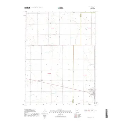
2019 Map of Haxtun West
USGS Topo · Published 2019About this map
Haxtun and the small settlement of Dailey anchor this high plains landscape along the border of Logan and Phillips Counties. The region is defined by its rectilinear grid of agricultural roads, such as Co RD 44 and Co RD 30, which support the dryland farming operations characteristic of northeastern Colorado. Seasonal drainage patterns are visible through the meandering paths of Wildhorse Cr and the N Fork Frenchman Cr, providing a rare break in the geometric precision of the township and range system. In the southeastern corner, the residential street plan of Haxtun includes W Grant St and S Washington Ave, adjacent to the Haxtun Cem. This map illustrates the intersection of small-town infrastructure and the vast ranching and farming acreage that sustains the local economy.
Find a feature on this map
36 named features on this map. Tap any name to fly to it.
Don’t see what you’re looking for? This feature index may not catch every label — zoom into the map to look around manually.
Map Details
Editions of this 2019 Haxtun West Map
This is the sole edition of this map. No revisions or reprints were ever made.
Other maps of this area

1952 · Marks Butte
USGS Topo · 1:24,000

1953 · Tamarack Ranch
USGS Topo · 1:24,000

1953 · Crook
USGS Topo · 1:24,000

1954 · Sterling
USGS Topo · 1:250,000

1958 · Sterling
USGS Topo · 1:250,000

1962 · Fleming
USGS Topo · 1:24,000

1962 · Haxtun East
USGS Topo · 1:24,000

1962 · Haxtun West
USGS Topo · 1:24,000

1971 · Haxtun SE
USGS Topo · 1:24,000

1972 · St Petersburg
USGS Topo · 1:24,000