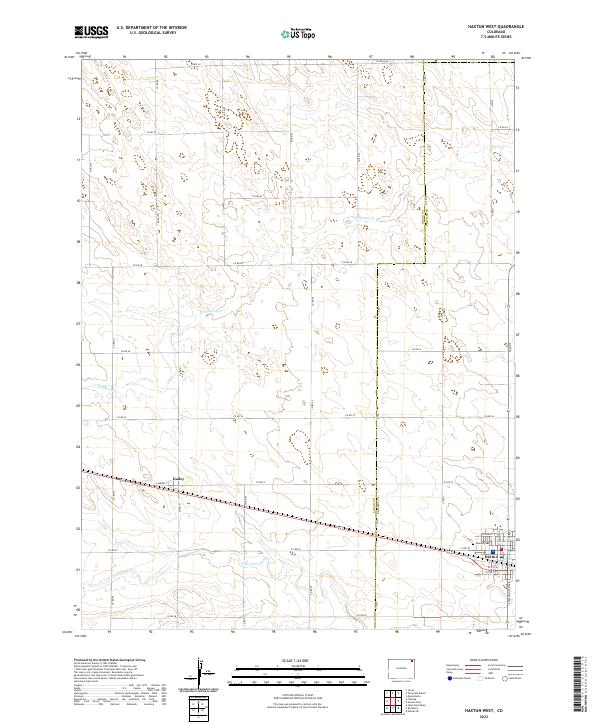
2022 Map of Haxtun West
USGS Topo · Published 2022About this map
Haxtun serves as the primary focal point of this Eastern Colorado landscape, situated along the southeastern edge of the map where grid-patterned streets like W Grant St and N Logan Ave define the town's layout. To the west lies the settlement of Dailey, connected to the regional hub by a network of county roads including Co RD 32 and Co RD 30. This agricultural region is defined by its sectional land divisions, with the Logan Co Phillips Co boundary line running vertically through the center of the sheet.
Find a feature on this map
30 named features on this map. Tap any name to fly to it.
Don’t see what you’re looking for? This feature index may not catch every label — zoom into the map to look around manually.
Map Details
Editions of this 2022 Haxtun West Map
This is the sole edition of this map. No revisions or reprints were ever made.
Other maps of this area

1952 · Marks Butte
USGS Topo · 1:24,000

1953 · Tamarack Ranch
USGS Topo · 1:24,000

1953 · Crook
USGS Topo · 1:24,000

1954 · Sterling
USGS Topo · 1:250,000

1958 · Sterling
USGS Topo · 1:250,000

1962 · Fleming
USGS Topo · 1:24,000

1962 · Haxtun East
USGS Topo · 1:24,000

1962 · Haxtun West
USGS Topo · 1:24,000

1971 · Haxtun SE
USGS Topo · 1:24,000

1972 · St Petersburg
USGS Topo · 1:24,000