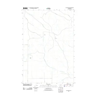
2011 Map of Hay Basin NE
USGS Topo · Published 2011About this map
The high plains of Yellowstone County are defined by a sparse network of coulees and rural resource extraction. Industrial activity is centered around the Berten Mine and Antelope Mine, situated near the confluence of local ridgelines and drainage basins. This area, north of the North County Line Rd and Border Rd, reveals a landscape managed for both water and mineral resources. The presence of the Wild Flower Dam along the western edge suggests localized efforts to control runoff for ranching or mining needs.
Find a feature on this map
16 named features on this map. Tap any name to fly to it.
Don’t see what you’re looking for? This feature index may not catch every label — zoom into the map to look around manually.
Map Details
Editions of this 2011 Hay Basin NE Map
This is the sole edition of this map. No revisions or reprints were ever made.
Other maps of this area

1954 · Roundup
USGS Topo · 1:250,000

1958 · Roundup
USGS Topo · 1:250,000

1979 · Roundup
USGS Topo · 1:100,000

1979 · Harper Coulee
USGS Topo · 1:24,000

1979 · Elso
USGS Topo · 1:24,000

1979 · Hay Basin NE
USGS Topo · 1:24,000
1980 · North Fork Crooked Creek East
USGS Topo · 1:24,000

1980 · Signal Mountain
USGS Topo · 1:24,000
1980 · North Fork Crooked Creek West
USGS Topo · 1:24,000
1980 · Park Coulee
USGS Topo · 1:24,000