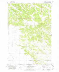
1980 Map of Signal Mountain
USGS Topo · Published 1980About this map
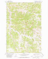
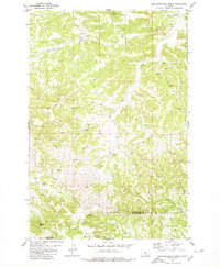
Signal Mtn and the nearby Elbow Hill rise above a complex network of drainages in this Musselshell County landscape during the late twentieth century. The terrain is defined by the headwaters of several key creeks, including Halfbreed Creek, West Parrot Creek, and East Parrot Creek, which carve into the rolling uplands. Human activity is centered on resource extraction and communication infrastructure, evidenced by scattered Strip Mine and Gravel Pit operations alongside a prominent Radio Tower in the southwest. The presence of numerous unnamed wells and Spring features suggests a reliance on groundwater for the ranching and mining operations that characterize the era. Sections are clearly marked following the Public Land Survey System, providing a structural grid over the winding course of Rehder Creek.
Find a feature on this map
13 named features on this map. Tap any name to fly to it.
Don’t see what you’re looking for? This feature index may not catch every label — zoom into the map to look around manually.
Map Details
Editions of this 1980 Signal Mountain Map
This is the sole edition of this map. No revisions or reprints were ever made.
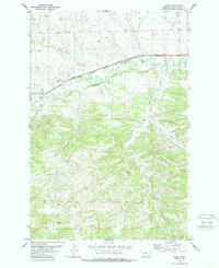
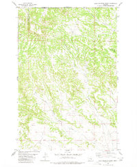
Other maps of this area

1954 · Roundup
USGS Topo · 1:250,000

1958 · Roundup
USGS Topo · 1:250,000
1979 · Roundup
USGS Topo · 1:100,000
1979 · Gage NE
USGS Topo · 1:24,000
1979 · Harper Coulee
USGS Topo · 1:24,000
1979 · Hay Basin NE
USGS Topo · 1:24,000
1979 · Gage
USGS Topo · 1:24,000
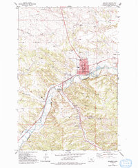
1979 · Roundup
USGS Topo · 1:24,000
1980 · Dunn Mountain South
USGS Topo · 1:24,000
1980 · Dunn Mountain North
USGS Topo · 1:24,000