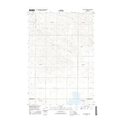
2017 Map of Hay Basin North
USGS Topo · Published 2017About this map
The Bull Mountains rise in the northeastern portion of this quadrangle, defining a landscape of high ridges and deep drainage basins at the boundary of Musselshell Co and Yellowstone County. The terrain is deeply incised by the waters of Dean Cr, the E Fork Dean Cr, and Fulcher Cr, which carve through the high plains. In the southern portion of the map, the eponymous Hay Basin represents a significant topographical depression, providing a natural catchment for local runoff.
Find a feature on this map
27 named features on this map. Tap any name to fly to it.
Don’t see what you’re looking for? This feature index may not catch every label — zoom into the map to look around manually.
Map Details
Editions of this 2017 Hay Basin North Map
This is the sole edition of this map. No revisions or reprints were ever made.
Other maps of this area

1954 · Roundup
USGS Topo · 1:250,000

1958 · Roundup
USGS Topo · 1:250,000

1979 · Roundup
USGS Topo · 1:100,000

1979 · Bundy
USGS Topo · 1:24,000

1979 · Harper Coulee
USGS Topo · 1:24,000

1979 · Elso
USGS Topo · 1:24,000

1979 · Hay Basin NE
USGS Topo · 1:24,000
1979 · Broadview East
USGS Topo · 1:24,000
1980 · Broadview NE
USGS Topo · 1:24,000
1980 · North Fork Crooked Creek West
USGS Topo · 1:24,000