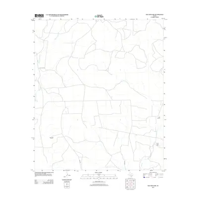
2012 Map of Hay Hollow
USGS Topo · Published 2012About this map
The Middle Concho River winds through this West Texas landscape, defining the hydrology of a region where water management is central to the land's utility. This survey illustrates a sparse ranching infrastructure where named landmarks often center on essential water sources, such as the Model A Windmill and Scallop Tank Windmill. These features, alongside the branching course of Kiowa Cr, speak to the historical necessity of capturing and directing seasonal runoff in Tom Green County. The terrain is characterized by broad depressions and natural drainage patterns, most notably Hay Hollow and the evocatively named Coon Dive Draw. These features are connected by a thin network of local thoroughfares like Middle Rd and Walker Rd, which facilitate movement between these isolated points of interest in an area where the natural geography continues to dictate human activity.
Find a feature on this map
8 named features on this map. Tap any name to fly to it.
Don’t see what you’re looking for? This feature index may not catch every label — zoom into the map to look around manually.
Map Details
Editions of this 2012 Hay Hollow Map
This is the sole edition of this map. No revisions or reprints were ever made.
Other maps of this area

1921 · Ketchum Mountain
USGS Topo · 1:62,500

1923 · Ketchum Mountain
USGS Topo · 1:62,500

1954 · San Angelo
USGS Topo · 1:250,000

1958 · San Angelo
USGS Topo · 1:250,000

1965 · San Angelo
USGS Topo · 1:250,000

1970 · South Mustang Draw NE
USGS Topo · 1:24,000

1973 · Hay Hollow
USGS Topo · 1:24,000
1973 · Bradford Draw
USGS Topo · 1:24,000

1973 · Three Bluff Draw
USGS Topo · 1:24,000
1973 · Coon Dive Draw
USGS Topo · 1:24,000