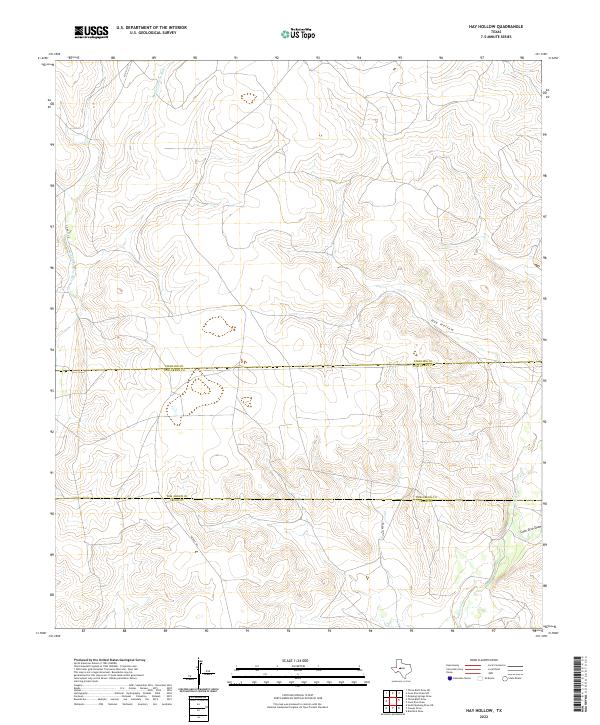
2022 Map of Hay Hollow
USGS Topo · Published 2022About this map
The Middle Concho River winds through the northwestern corner of this landscape, marking a significant hydrologic feature in a region defined by its drainage patterns. This survey illustrates the convergence of three Texas counties, where the boundaries of Sterling, Tom Green, and Irion meet across a terrain etched by seasonal watercourses. Notable among these are Hay Hollow and the drainage of Coon Dive Draw in the southeast, which shape the local topography. A network of rural routes, including Middle Rd and Walker Rd, provides access to the interior ranchlands. The map clearly delineates the seasonal nature of the local hydrography, with Kiowa Cr cutting through the southern sections, reflecting the arid character of the Edwards Plateau transition.
Find a feature on this map
9 named features on this map. Tap any name to fly to it.
Don’t see what you’re looking for? This feature index may not catch every label — zoom into the map to look around manually.
Map Details
Editions of this 2022 Hay Hollow Map
This is the sole edition of this map. No revisions or reprints were ever made.
Other maps of this area

1921 · Ketchum Mountain
USGS Topo · 1:62,500

1923 · Ketchum Mountain
USGS Topo · 1:62,500

1954 · San Angelo
USGS Topo · 1:250,000

1958 · San Angelo
USGS Topo · 1:250,000

1965 · San Angelo
USGS Topo · 1:250,000

1970 · South Mustang Draw NE
USGS Topo · 1:24,000

1973 · Hay Hollow
USGS Topo · 1:24,000
1973 · Bradford Draw
USGS Topo · 1:24,000

1973 · Three Bluff Draw
USGS Topo · 1:24,000
1973 · Coon Dive Draw
USGS Topo · 1:24,000