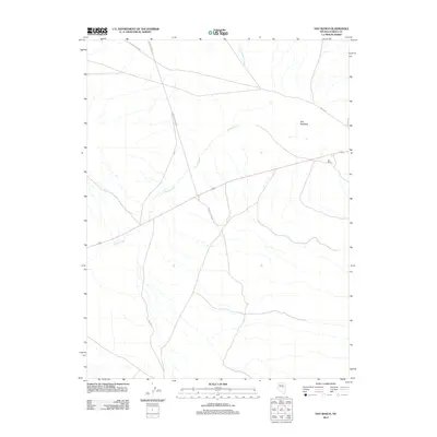
2012 Map of Hay Ranch
USGS Topo · Published 2012About this map
Hay Ranch serves as a primary point of reference in this high-desert landscape of Eureka County, situated near the expansive Hay Meadow. The map reveals a land defined by its drainage patterns and utilitarian road network, where Slough Creek and the uniquely named Uans-in-dame Creek move through the open terrain. Human activity is traced along remote thoroughfares like Roberts Creek Rd and 3 Bar to Lone Mtn, reflecting the persistent cattle ranching and land management practices of the Great Basin. This 2012 survey captures the spatial relationship between these water sources and the named routes that connect the scattered improvements in this isolated region.
Find a feature on this map
8 named features on this map. Tap any name to fly to it.
Don’t see what you’re looking for? This feature index may not catch every label — zoom into the map to look around manually.
Map Details
Editions of this 2012 Hay Ranch Map
This is the sole edition of this map. No revisions or reprints were ever made.
Other maps of this area

1926 · Roberts Mountains
USGS Topo · 1:250,000

1929 · Roberts Mountains
USGS Topo · 1:250,000

1955 · Millett
USGS Topo · 1:250,000

1956 · Bellevue Peak
USGS Topo · 1:62,500

1956 · Bartine Ranch
USGS Topo · 1:62,500

1956 · Antelope Peak
USGS Topo · 1:62,500

1956 · Whistler Mtn
USGS Topo · 1:62,500

1959 · Millett
USGS Topo · 1:250,000

1978 · Summit Mountain
USGS Topo · 1:100,000

1979 · Simpson Park Mtns
USGS Topo · 1:100,000