
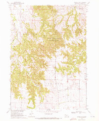
1966 Map of Hay Springs NE
USGS Topo · Published 1967About this map
Walgren Lake sits in the southwestern corner of this 1966 topographic survey, marking a distinct water feature in the high plains of Sheridan County. The landscape is defined by the transition between the Hay Springs and Rushville precincts, where the Chicago and North Western railroad cuts a straight line across the northern half of the quadrangle. This transit corridor was essential for the agricultural economy of the era, connecting remote rural schoolhouses like Green Valley Sch and Prairie Center Sch to larger regional hubs.
Find a feature on this map
8 named features on this map. Tap any name to fly to it.
Don’t see what you’re looking for? This feature index may not catch every label — zoom into the map to look around manually.
Map Details
Editions of this 1966 Hay Springs NE Map
This is the sole edition of this map. No revisions or reprints were ever made.
Other maps of this area

1955 · Alliance
USGS Topo · 1:250,000

1957 · Alliance
USGS Topo · 1:250,000

1958 · Alliance
USGS Topo · 1:250,000

1960 · Hay Springs SW
USGS Topo · 1:24,000

1960 · Hay Springs SE
USGS Topo · 1:24,000

1966 · Rushville
USGS Topo · 1:24,000

1966 · Rushville SW
USGS Topo · 1:24,000

1966 · Hay Springs
USGS Topo · 1:24,000

1969 · Clinton SW
USGS Topo · 1:24,000
1969 · Whiteclay SW
USGS Topo · 1:24,000