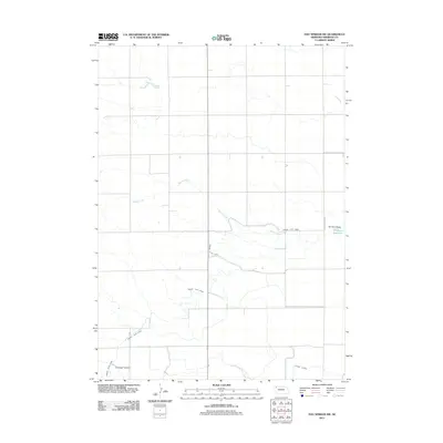
2011 Map of Hay Springs SW
USGS Topo · Published 2011About this map
Spring Creek meanders through this portion of Sheridan County, illustrating the agricultural water management systems vital to the Nebraska panhandle. The landscape is defined by the Mirage Flats Canal, which snakes across the terrain to provide irrigation to the surrounding plains. This network is supported by smaller distribution channels such as the Sturgeon Lateral and Peters Lateral, demonstrating the engineered approach to prairie farming in the early 21st century. In the eastern reaches, the Dorshorst Dam contains the Dorshorst Reservoir, a significant local water feature. The map shows a transition from natural drainage patterns to a highly organized system of canals and access routes like Walgren Lake Rd, reflecting the long-term human modification of this grassland environment for stable agriculture.
Find a feature on this map
7 named features on this map. Tap any name to fly to it.
Don’t see what you’re looking for? This feature index may not catch every label — zoom into the map to look around manually.
Map Details
Editions of this 2011 Hay Springs SW Map
This is the sole edition of this map. No revisions or reprints were ever made.
Other maps of this area

1947 · Box Butte NE
USGS Topo · 1:24,000

1949 · Box Butte NE
USGS Topo · 1:24,000

1950 · Skunk Lake
USGS Topo · 1:62,500

1955 · Alliance
USGS Topo · 1:250,000

1957 · Alliance
USGS Topo · 1:250,000

1958 · Alliance
USGS Topo · 1:250,000

1960 · Hay Springs SW
USGS Topo · 1:24,000

1960 · Hay Springs SE
USGS Topo · 1:24,000

1966 · Chadron 3 SE
USGS Topo · 1:24,000

1966 · Hay Springs NE
USGS Topo · 1:24,000