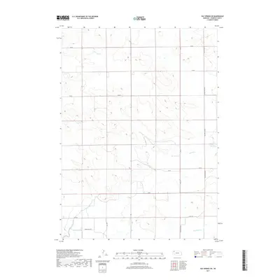
2017 Map of Hay Springs SW
USGS Topo · Published 2017About this map
Spring Cr meanders across the high plains of Sheridan County, highlighting the vital role of water management in this agricultural landscape. The western reaches of the quadrangle are marked by the Mirage Flats Canal, part of a complex irrigation system that includes the Sturgeon Lateral, Fairfield Lateral, and Peters Lateral. This network reflects the transition from dryland ranching to irrigated farming, a shift essential for the region's productivity. In the eastern portion, the Dorshorst Reservoir stands as a significant landmark for local water storage. The map's grid is defined by rural thoroughfares such as Walgren Lake Rd and Pepper Creek Rd, which provide access to the vast open spaces between the occasional draws and natural drainages that define this Nebraska terrain.
Find a feature on this map
20 named features on this map. Tap any name to fly to it.
Don’t see what you’re looking for? This feature index may not catch every label — zoom into the map to look around manually.
Map Details
Editions of this 2017 Hay Springs SW Map
This is the sole edition of this map. No revisions or reprints were ever made.
Other maps of this area

1947 · Box Butte NE
USGS Topo · 1:24,000

1949 · Box Butte NE
USGS Topo · 1:24,000

1950 · Skunk Lake
USGS Topo · 1:62,500

1955 · Alliance
USGS Topo · 1:250,000

1957 · Alliance
USGS Topo · 1:250,000

1958 · Alliance
USGS Topo · 1:250,000

1960 · Hay Springs SW
USGS Topo · 1:24,000

1960 · Hay Springs SE
USGS Topo · 1:24,000

1966 · Chadron 3 SE
USGS Topo · 1:24,000

1966 · Hay Springs NE
USGS Topo · 1:24,000