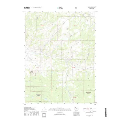
2019 Map of Hayden Gulch
USGS Topo · Published 2019About this map
The Williams Fork Mountains dominate this high-altitude landscape in Routt County, where complex drainage systems and water management define the terrain. The area is characterized by numerous small-scale water storage sites, including Dillabaugh Reservoir, Detwiller Reservoir, and Wyman Reservoir, which suggest the historic and ongoing importance of water rights for ranching and forest management. The southern reaches are protected by the Routt National Forest, covering the prominent Beaver Flat Tops and the headwaters of the E Fork Williams Fork. This 2019 survey documents a network of named canyons and gulches, such as Watering Trough Gulch and Hubberson Gulch, alongside more modern infrastructure like Co RD 53 and Co RD 29, illustrating how the land has been subdivided for both public use and private utility.
Find a feature on this map
39 named features on this map. Tap any name to fly to it.
Don’t see what you’re looking for? This feature index may not catch every label — zoom into the map to look around manually.
Map Details
Editions of this 2019 Hayden Gulch Map
This is the sole edition of this map. No revisions or reprints were ever made.
Other maps of this area

1916 · Daton Peak
USGS Topo · 1:62,500

1920 · Daton Peak
USGS Topo · 1:62,500

1924 · Mt. Harris
USGS Topo · 1:48,000

1926 · Mount Harris
USGS Topo · 1:62,500

1954 · Craig
USGS Topo · 1:250,000

1957 · Craig
USGS Topo · 1:250,000

1958 · Craig
USGS Topo · 1:250,000

1960 · Craig
USGS Topo · 1:250,000

1962 · Craig
USGS Topo · 1:250,000

1964 · Craig
USGS Topo · 1:250,000