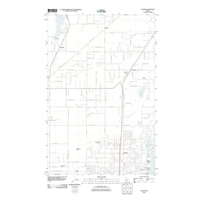
2010 Map of Hayden
USGS Topo · Published 2010About this map
Hayden and its surrounding northern Idaho landscape are defined by a complex transition from the flat Rathdrum Prairie to the water-rich margins of the Purcell Trench. This 2010 survey shows a region deeply influenced by aviation and water management, featuring multiple landing strips like the Coeur D'Alene Air Terminal, Ranch Aero Airport, and Hawk Haven Airport. The eastern edge of the map reveals the residential and recreational development along the shores of Hayden Lake, including Honeysuckle Beach.
Find a feature on this map
69 named features on this map. Tap any name to fly to it.
Don’t see what you’re looking for? This feature index may not catch every label — zoom into the map to look around manually.
Map Details
Editions of this 2010 Hayden Map
This is the sole edition of this map. No revisions or reprints were ever made.
Other maps of this area

1903 · Rathdrum
USGS Topo · 1:125,000

1955 · Spokane
USGS Topo · 1:250,000

1957 · Coeur D'Alene
USGS Topo · 1:62,500

1957 · Lane
USGS Topo · 1:62,500

1958 · Spokane
USGS Topo · 1:250,000

1961 · Hayden
USGS Topo · 1:24,000

1961 · Rathdrum
USGS Topo · 1:24,000

1961 · Spirit Lake East
USGS Topo · 1:24,000

1961 · Athol
USGS Topo · 1:24,000
1961 · Spirit Lake West
USGS Topo · 1:24,000