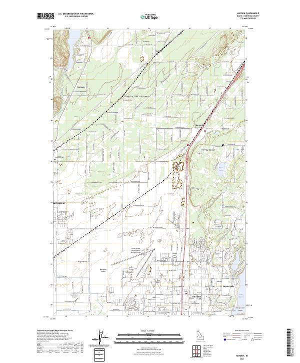
2024 Map of Hayden
USGS Topo · Published 2024About this map
Hayden and the eastern edge of the Rathdrum Prairie serve as the focal points for this 2024 survey of Kootenai County. The landscape is defined by the transition from the open expanses of the prairie to the irregular shoreline of Hayden Lake, where specialized features like Honeysuckle Beach and Bozanta Tavern Bay mark the interface between land and water. The map reveals a high density of transport infrastructure, notably the Coeur d'Alene Airport/Pappy Boyington Field and the smaller Hawk Haven Airport.
Find a feature on this map
88 named features on this map. Tap any name to fly to it.
Don’t see what you’re looking for? This feature index may not catch every label — zoom into the map to look around manually.
Map Details
Editions of this 2024 Hayden Map
This is the sole edition of this map. No revisions or reprints were ever made.
Other maps of this area

1903 · Rathdrum
USGS Topo · 1:125,000

1955 · Spokane
USGS Topo · 1:250,000

1957 · Coeur D'Alene
USGS Topo · 1:62,500

1957 · Lane
USGS Topo · 1:62,500

1958 · Spokane
USGS Topo · 1:250,000

1961 · Hayden
USGS Topo · 1:24,000

1961 · Rathdrum
USGS Topo · 1:24,000

1961 · Spirit Lake East
USGS Topo · 1:24,000

1961 · Athol
USGS Topo · 1:24,000
1961 · Spirit Lake West
USGS Topo · 1:24,000