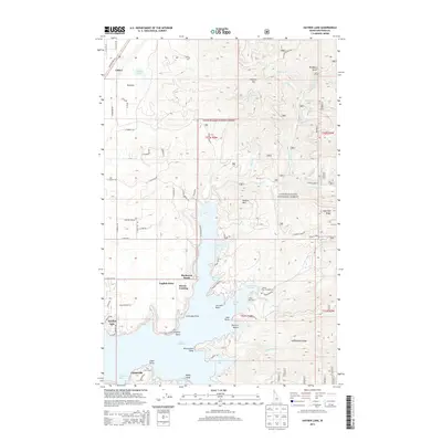
2013 Map of Hayden Lake
USGS Topo · Published 2013About this map
Lake Hayden serves as the central focal point of this Kootenai County survey, its irregular shoreline defined by numerous bays and points. The landscape is characterized by the transition from the protected waters of McLeans Bay and Skinner Bay to the rising elevations of Hollister Mtn and Hudlow Mtn within the Coeur d'Alene National Forest. Established settlements and landing sites like Rockaway Beach, Harris Landing, and Clarksville dot the western and southern shores, reflecting the area's long-standing appeal for lakeside residence and recreation. Near the southern edge, The Clark House and Camp Mivoden mark significant cultural footprints along the water. Further north, the terrain shifts toward more open land near Chilco and the quiet waters of Chilco Lake, while a network of forest roads like Burnt Cabin Rd and E Hayden Lake Rd provide access to the interior ridges and drainages such as Mokins Cr and N Fork Hayden Cr.
Find a feature on this map
87 named features on this map. Tap any name to fly to it.
Don’t see what you’re looking for? This feature index may not catch every label — zoom into the map to look around manually.
Map Details
Editions of this 2013 Hayden Lake Map
This is the sole edition of this map. No revisions or reprints were ever made.
Other maps of this area

1903 · Rathdrum
USGS Topo · 1:125,000

1955 · Spokane
USGS Topo · 1:250,000

1957 · Coeur D'Alene
USGS Topo · 1:62,500

1957 · Lane
USGS Topo · 1:62,500

1958 · Spokane
USGS Topo · 1:250,000

1961 · Hayden
USGS Topo · 1:24,000

1961 · Bayview
USGS Topo · 1:24,000

1961 · Spirit Lake East
USGS Topo · 1:24,000

1961 · Athol
USGS Topo · 1:24,000

1961 · Spirit Lake
USGS Topo · 1:62,500