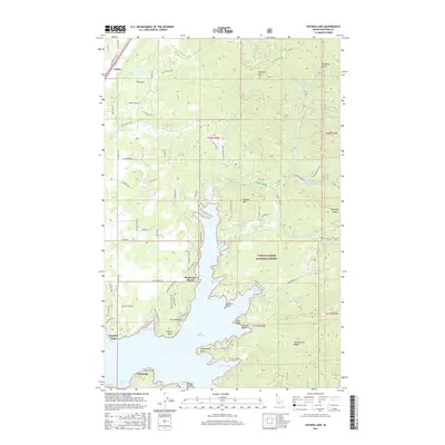
2017 Map of Hayden Lake
USGS Topo · Published 2017About this map
Lake Hayden serves as the dominant center of this North Idaho landscape, its intricate shoreline defined by numerous bays and points. The eastern half of the map is largely occupied by the Coeur D'Alene National Forest, where steep drainages like Mokins Cr and Yellowbanks Cr flow toward the water. Settlement patterns show a clear concentration of residential roads along the western shore and the northern agricultural flats, where Chilco and Rimrock sit near the base of Hollister Mtn.
Find a feature on this map
94 named features on this map. Tap any name to fly to it.
Don’t see what you’re looking for? This feature index may not catch every label — zoom into the map to look around manually.
Map Details
Editions of this 2017 Hayden Lake Map
This is the sole edition of this map. No revisions or reprints were ever made.
Other maps of this area

1903 · Rathdrum
USGS Topo · 1:125,000

1955 · Spokane
USGS Topo · 1:250,000

1957 · Coeur D'Alene
USGS Topo · 1:62,500

1957 · Lane
USGS Topo · 1:62,500

1958 · Spokane
USGS Topo · 1:250,000

1961 · Hayden
USGS Topo · 1:24,000

1961 · Bayview
USGS Topo · 1:24,000

1961 · Spirit Lake East
USGS Topo · 1:24,000

1961 · Athol
USGS Topo · 1:24,000

1961 · Spirit Lake
USGS Topo · 1:62,500