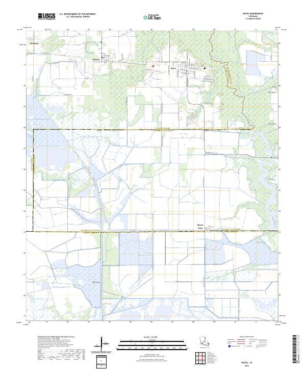
2024 Map of Hayes
USGS Topo · Published 2024About this map
Hayes and Bell City anchor this landscape where the coastal prairie meets the marshlands of Southwest Louisiana. The map reveals a transition from organized agricultural grids defined by Rossignol Rd and Pumkin Center Rd to the expansive conservation lands of the Lacassine National Wildlife Refuge. In the settlement of Hayes, local heritage is marked by the Hayes Cem and a network of residential streets like Texas Ave and Mississippi Ave.
Find a feature on this map
44 named features on this map. Tap any name to fly to it.
Don’t see what you’re looking for? This feature index may not catch every label — zoom into the map to look around manually.
Map Details
Editions of this 2024 Hayes Map
This is the sole edition of this map. No revisions or reprints were ever made.
Other maps of this area

1932 · Lake Charles NE
USGS Topo · 1:31,680

1932 · Lake Charles SE
USGS Topo · 1:31,680

1934 · Lake Misere
USGS Topo · 1:24,000

1934 · Boudreaux Lake
USGS Topo · 1:24,000

1934 · Latania Lake
USGS Topo · 1:24,000

1935 · Lake Misere
USGS Topo · 1:31,680

1935 · Latania Lake
USGS Topo · 1:31,680

1935 · Boudreaux Lake
USGS Topo · 1:31,680

1942 · Lake Charles
USGS Topo · 1:62,500

1946 · Lacassine
USGS Topo · 1:31,680