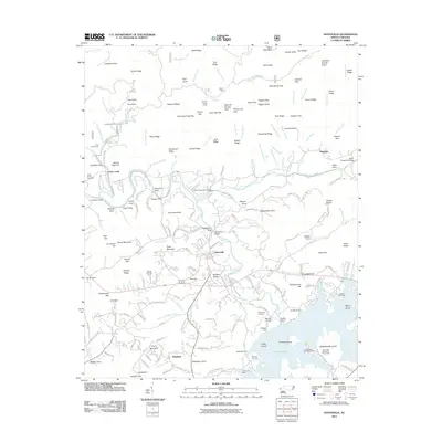
2011 Map of Hayesville
USGS Topo · Published 2011About this map
Hayesville serves as the focal point of this region, situated where the Hiwassee River meets the expansive waters of Chatuge Lake. The landscape is defined by the tension between the valley's developed infrastructure and the steep, named ridges of the surrounding mountains. In the south, the Chatuge Dam and its associated structures, including Saddle Dam 1 and Saddle Dam 2, show the engineering that shaped the modern lakefront, while Jackrabbit Mountain Picnic Area points to the area's recreational evolution. Genealogists will find a wealth of local markers, from the Hayesville Cemetery and McClure Cemetery to smaller family-named settlements like Shewbird and Tusquitee. The northern portion of the map is dominated by the Fires Creek watershed, a maze of peaks like Shortoff Knob and gaps such as Shearer Gap that reflect the traditional land use and terrain of the western North Carolina mountains.
Find a feature on this map
232 named features on this map. Tap any name to fly to it.
Don’t see what you’re looking for? This feature index may not catch every label — zoom into the map to look around manually.
Map Details
Editions of this 2011 Hayesville Map
This is the sole edition of this map. No revisions or reprints were ever made.
Other maps of this area

1886 · Dahlonega
USGS Topo · 1:125,000

1892 · Dahlonega
USGS Topo · 1:125,000

1896 · Dahlonega
USGS Topo · 1:125,000

1903 · Dahlonega
USGS Topo · 1:125,000

1935 · Peachtree
USGS Topo · 1:24,000

1935 · Osborn
USGS Topo · 1:24,000

1935 · Shooting Creek
USGS Topo · 1:24,000

1935 · Topton
USGS Topo · 1:24,000

1935 · Marble
USGS Topo · 1:24,000

1935 · Wayah Bald
USGS Topo · 1:48,000