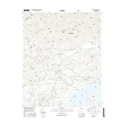
2016 Map of Hayesville
USGS Topo · Published 2016About this map
The Hiwassee River and its varied tributaries define the settlement patterns of this Clay County landscape, where the town of Hayesville sits at the junction of valley life and the towering Nantahala National Forest. The map documents the intricate network of coves and ridges that shape the region, including Matheson Cove and Sewell Cove. Local history is preserved through the locations of numerous family and community landmarks, such as Hayesville Cemetery and Myers Chapel. The terrain transitions from the developed corridors along Bus 64 to the high elevations of the Valley River Mountains and Snake Ridge. Waterways like Tusquitee Creek and Fires Creek are crossed by locally significant spans including the Lower Tusquitee Bridge and Sanderson Bridge, illustrating how the community navigates the river valley's geography. Researchers will find numerous cemeteries like McClure Cem and Ledford Cem plotted alongside established residential areas and the high peaks of Graveyard High Top.
Find a feature on this map
234 named features on this map. Tap any name to fly to it.
Don’t see what you’re looking for? This feature index may not catch every label — zoom into the map to look around manually.
Map Details
Editions of this 2016 Hayesville Map
This is the sole edition of this map. No revisions or reprints were ever made.
Other maps of this area

1886 · Dahlonega
USGS Topo · 1:125,000

1892 · Dahlonega
USGS Topo · 1:125,000

1896 · Dahlonega
USGS Topo · 1:125,000

1903 · Dahlonega
USGS Topo · 1:125,000

1935 · Peachtree
USGS Topo · 1:24,000

1935 · Osborn
USGS Topo · 1:24,000

1935 · Shooting Creek
USGS Topo · 1:24,000

1935 · Topton
USGS Topo · 1:24,000

1935 · Marble
USGS Topo · 1:24,000

1935 · Wayah Bald
USGS Topo · 1:48,000