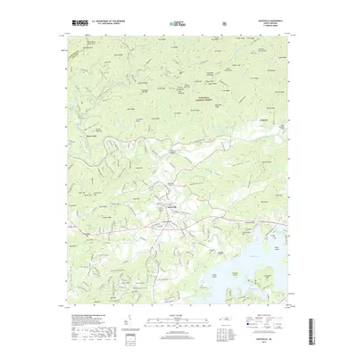
2019 Map of Hayesville
USGS Topo · Published 2019About this map
Hayesville serves as the focal point of this 2019 survey, situated where the Hiwassee River meets the northern reaches of Chatuge Lake. The landscape is defined by the sharp transition from the river valley's residential and agricultural corridors to the protected high country of the Nantahala National Forest. To the north, the Tusquitee Mountains rise steeply, punctuated by landmarks such as Wolf Ridge and the Tusquitee settlement along Tusquitee Creek. The map records numerous family-named burial grounds and coves that reflect the deep-rooted settlement patterns of Clay County, including Hayesville Cem, Ledford Cem, and McClure Cem. Cultural landmarks like the Philadelphia Church Cove and the local Post Office are documented alongside a modern network of forest roads and trails, including the Rim Trail, which traces the high ridges and gaps of the surrounding peaks.
Find a feature on this map
251 named features on this map. Tap any name to fly to it.
Don’t see what you’re looking for? This feature index may not catch every label — zoom into the map to look around manually.
Map Details
Editions of this 2019 Hayesville Map
This is the sole edition of this map. No revisions or reprints were ever made.
Other maps of this area

1886 · Dahlonega
USGS Topo · 1:125,000

1892 · Dahlonega
USGS Topo · 1:125,000

1896 · Dahlonega
USGS Topo · 1:125,000

1903 · Dahlonega
USGS Topo · 1:125,000

1935 · Peachtree
USGS Topo · 1:24,000

1935 · Osborn
USGS Topo · 1:24,000

1935 · Shooting Creek
USGS Topo · 1:24,000

1935 · Topton
USGS Topo · 1:24,000

1935 · Marble
USGS Topo · 1:24,000

1935 · Wayah Bald
USGS Topo · 1:48,000