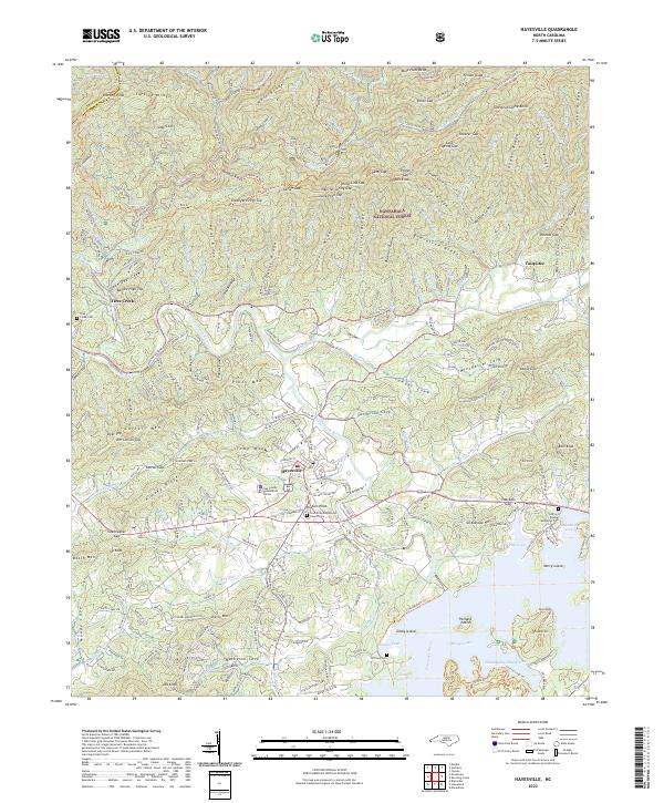
2022 Map of Hayesville
USGS Topo · Published 2022About this map
Hayesville serves as the focal point of this Western North Carolina landscape, where the Hiwassee River winds through a valley defined by the Tusquitee Mountains. The map reveals a community structured around its civic and spiritual centers, notably the Clay County Government Center and historic burial grounds like the First United Methodist Church Cem and Ledford Chapel Methodist Cem. To the north, the terrain rises sharply into the Nantahala National Forest, a dense network of ridges such as Kimsey Ridge and Graveyard Ridge cut by numerous watercourses including Fires Creek and Tusquitee Creek. The southern portion of the sheet is dominated by the waters of Chatuge Lake, where islands like Gibby Island and Penland Island break the surface. This cartographic study illustrates the settlement patterns of Clay County, showing how residential growth along roads like Old HWY 64 W follows the natural contours of the river valley and the foothills of the Blue Ridge.
Find a feature on this map
221 named features on this map. Tap any name to fly to it.
Don’t see what you’re looking for? This feature index may not catch every label — zoom into the map to look around manually.
Map Details
Editions of this 2022 Hayesville Map
This is the sole edition of this map. No revisions or reprints were ever made.
Other maps of this area

1886 · Dahlonega
USGS Topo · 1:125,000

1892 · Dahlonega
USGS Topo · 1:125,000

1896 · Dahlonega
USGS Topo · 1:125,000

1903 · Dahlonega
USGS Topo · 1:125,000

1935 · Peachtree
USGS Topo · 1:24,000

1935 · Osborn
USGS Topo · 1:24,000

1935 · Shooting Creek
USGS Topo · 1:24,000

1935 · Topton
USGS Topo · 1:24,000

1935 · Marble
USGS Topo · 1:24,000

1935 · Wayah Bald
USGS Topo · 1:48,000