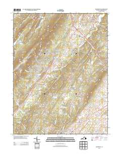
2013 Map of Hayfield
USGS Topo · Published 2013About this map
Shawnee Land serves as a central residential node in this portion of Frederick County, featuring a dense network of roads named for indigenous tribes, such as Tomahawk Trl and Shenandoah Trl. This developed area sits between the eastern slopes of Cove Ridge and the winding course of Hogue Creek. To the east, the landscape transitions into agricultural and larger estate holdings, including the Marker-Miller Orchards and High Hill Farm.
Find a feature on this map
218 named features on this map. Tap any name to fly to it.
Don’t see what you’re looking for? This feature index may not catch every label — zoom into the map to look around manually.
Map Details
Editions of this 2013 Hayfield Map
This is the sole edition of this map. No revisions or reprints were ever made.
Other maps of this area

1894 · Winchester
USGS Topo · 1:125,000

1914 · Gerrardstown
USGS Topo · 1:48,000

1916 · Gerrardstown
USGS Topo · 1:62,500

1916 · Capon Bridge
USGS Topo · 1:62,500

1923 · Middletown
USGS Topo · 1:62,500

1923 · Capon Bridge
USGS Topo · 1:62,500

1937 · Capon Bridge
USGS Topo · 1:48,000

1937 · Gerrardstown
USGS Topo · 1:48,000

1937 · Middletown
USGS Topo · 1:48,000

1938 · Winchester
USGS Topo · 1:48,000