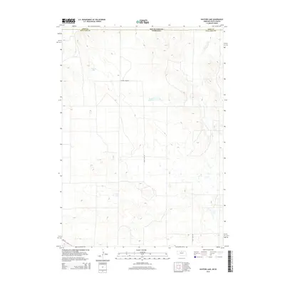
2014 Map of Hayford Lake
USGS Topo · Published 2014About this map
The Nebraska-South Dakota border defines the northern edge of this landscape, where Keya Paha Co meets Tripp Co. This section of the Sandhills region is characterized by a complex network of intermittent drainage and localized basins, centered on water bodies like Hayford Lake and the Worth Reservoir. The terrain is shaped by the winding courses of Shadley Cr and Lost Cr, which carve through the undulating topography. Human presence is marked by a sparse but deliberate road network, including Turkey Creek Rd and the southern alignment of Ne 12, illustrating the remote, agricultural character of the high plains in the early twenty-first century.
Find a feature on this map
8 named features on this map. Tap any name to fly to it.
Don’t see what you’re looking for? This feature index may not catch every label — zoom into the map to look around manually.
Map Details
Editions of this 2014 Hayford Lake Map
This is the sole edition of this map. No revisions or reprints were ever made.
Other maps of this area

1950 · Norden
USGS Topo · 1:62,500

1950 · Huddle Table
USGS Topo · 1:24,000

1952 · Norden
USGS Topo · 1:62,500

1955 · Martin
USGS Topo · 1:250,000

1955 · Mitchell
USGS Topo · 1:250,000

1955 · O'Neill
USGS Topo · 1:250,000

1957 · Valentine
USGS Topo · 1:250,000

1958 · Martin
USGS Topo · 1:250,000

1959 · Valentine
USGS Topo · 1:250,000

1959 · O'Neill
USGS Topo · 1:250,000