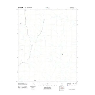
2012 Map of Hayford Peak SE
USGS Topo · Published 2012About this map
Mormon Pass sits at the high point of this high-desert landscape in northern Clark County, serving as a gateway between the Sheep Range to the west and the Las Vegas Range to the east. The terrain is defined by dramatic elevation shifts, anchored by peaks like Bald Knob and Quartzite Mountain. Evidence of water management in this arid environment appears at Searles Reservoir, while the deep cuts of Peek-a-boo Canyon illustrate the erosive power of seasonal runoff. Movement through the area is restricted to narrow primitive routes, primarily Mormon Well Rd and Wamp Springs Rd, which follow the natural contours of the desert floor and mountain gaps. This 2012 survey captures the area's undeveloped character and its persistent role as a rugged transition zone between two major mountain systems.
Find a feature on this map
9 named features on this map. Tap any name to fly to it.
Don’t see what you’re looking for? This feature index may not catch every label — zoom into the map to look around manually.
Map Details
Editions of this 2012 Hayford Peak SE Map
This is the sole edition of this map. No revisions or reprints were ever made.
Other maps of this area

1886 · Saint Thomas
USGS Topo · 1:250,000

1893 · Saint Thomas
USGS Topo · 1:250,000

1907 · Las Vegas
USGS Topo · 1:250,000

1908 · Las Vegas
USGS Topo · 1:250,000

1926 · Boulder Canyon
USGS Topo · 1:96,000

1945 · Sheep Range
USGS Topo · 1:125,000

1952 · Gass Peak
USGS Topo · 1:62,500

1952 · Dry Lake
USGS Topo · 1:62,500

1954 · Las Vegas
USGS Topo · 1:250,000

1957 · Las Vegas
USGS Topo · 1:250,000