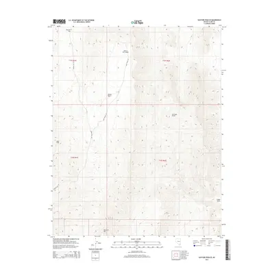
2014 Map of Hayford Peak SE
USGS Topo · Published 2014About this map
The Las Vegas Range dominates this portion of the northern Mojave Desert, where high-elevation landforms define the territory of southern Nevada. This 2014 survey captures a landscape of steep elevation changes, punctuated by summits like Quartzite Mtn and Bald Knob. Access into this arid interior is limited to a handful of unpaved routes, most notably Mormon Well Rd and Wamp Springs Rd, which follow the natural contours of the terrain. The presence of Mormon Pass in the northwest and the secluded Hidden Valley in the southeast suggests a complex topography of ridges and basins. North of the range, the playfully named Peek-a-boo Canyon cuts through the desert floor, offering a look at the drainage patterns that shape this protected wilderness area.
Find a feature on this map
13 named features on this map. Tap any name to fly to it.
Don’t see what you’re looking for? This feature index may not catch every label — zoom into the map to look around manually.
Map Details
Editions of this 2014 Hayford Peak SE Map
This is the sole edition of this map. No revisions or reprints were ever made.
Other maps of this area

1886 · Saint Thomas
USGS Topo · 1:250,000

1893 · Saint Thomas
USGS Topo · 1:250,000

1907 · Las Vegas
USGS Topo · 1:250,000

1908 · Las Vegas
USGS Topo · 1:250,000

1926 · Boulder Canyon
USGS Topo · 1:96,000

1945 · Sheep Range
USGS Topo · 1:125,000

1952 · Gass Peak
USGS Topo · 1:62,500

1952 · Dry Lake
USGS Topo · 1:62,500

1954 · Las Vegas
USGS Topo · 1:250,000

1957 · Las Vegas
USGS Topo · 1:250,000