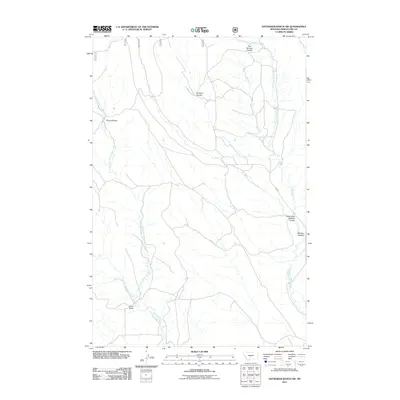
2011 Map of Haymaker Ranch SW
USGS Topo · Published 2011About this map
Manger Millsite stands as a focal point of human activity within this drainage-rich section of Wheatland County. The landscape is defined by an intricate network of waterways and dry washes, most notably the winding paths of Daisy Dean Creek and the Dry Fork Daisy Dean Creek. These streams are complemented by a series of geographic coulees, such as Pierce Coulee and Barnhart Coulee, which illustrate the natural erosional patterns characteristic of the Montana plains.
Find a feature on this map
12 named features on this map. Tap any name to fly to it.
Don’t see what you’re looking for? This feature index may not catch every label — zoom into the map to look around manually.
Map Details
Editions of this 2011 Haymaker Ranch SW Map
This is the sole edition of this map. No revisions or reprints were ever made.
Other maps of this area

1886 · Little Belt Mts.
USGS Topo · 1:250,000

1894 · Little Belt Mts.
USGS Topo · 1:250,000

1897 · Little Belt Mts.
USGS Topo · 1:250,000

1898 · Little Belt Mts.
USGS Topo · 1:250,000

1902 · Little Belt Mts.
USGS Topo · 1:250,000

1948 · White Sulphur Springs
USGS Topo · 1:250,000

1958 · White Sulphur Springs
USGS Topo · 1:250,000

1961 · White Sulphur Springs
USGS Topo · 1:250,000

1965 · White Sulphur Springs
USGS Topo · 1:250,000
1972 · Daisy Peak
USGS Topo · 1:24,000