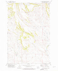
1972 Map of Haymaker Ranch SW
USGS Topo · Published 1976About this map
The Olaf Community Center stands as a primary landmark in this rural Wheatland County landscape, situated where the high plains meet the northern reaches of the Lewis and Clark National Forest. The map detail reveals a complex network of seasonal drainage and perennial flows that have shaped the ranching history of the area. Significant watercourses including Clarks Fork, Haymaker Creek, and Daisy Dean Creek cut through the terrain, flanked by numerous named coulees such as Morrisy Coulee and Barnhart Coulee. This 1970s survey captures a snapshot of the region's agricultural infrastructure, including a Flowing Well and a Gravel Pit, illustrating how water management and local resource extraction supported the remote communities and ranches nestled within these creek valleys.
Find a feature on this map
16 named features on this map. Tap any name to fly to it.
Don’t see what you’re looking for? This feature index may not catch every label — zoom into the map to look around manually.
Map Details
Editions of this 1972 Haymaker Ranch SW Map
This is the sole edition of this map. No revisions or reprints were ever made.
Other maps of this area

1886 · Little Belt Mts.
USGS Topo · 1:250,000

1894 · Little Belt Mts.
USGS Topo · 1:250,000

1897 · Little Belt Mts.
USGS Topo · 1:250,000

1898 · Little Belt Mts.
USGS Topo · 1:250,000

1902 · Little Belt Mts.
USGS Topo · 1:250,000

1948 · White Sulphur Springs
USGS Topo · 1:250,000

1958 · White Sulphur Springs
USGS Topo · 1:250,000

1961 · White Sulphur Springs
USGS Topo · 1:250,000

1965 · White Sulphur Springs
USGS Topo · 1:250,000
1972 · Daisy Peak
USGS Topo · 1:24,000