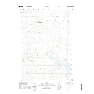
2017 Map of Haynes SE
USGS Topo · Published 2017About this map
The Grand River National Grassland dominates the northern half of this Perkins County landscape, representing a vast expanse of public prairie conservation. This modern survey illustrates the hydrology of the High Plains, where the North Fork Grand River and Flat Creek converge amidst a complex network of seasonal wetlands and reservoirs. The presence of Johnson Dam along the river's path highlights mid-century water management efforts essential for ranching and agriculture in this semi-arid region.
Find a feature on this map
19 named features on this map. Tap any name to fly to it.
Don’t see what you’re looking for? This feature index may not catch every label — zoom into the map to look around manually.
Map Details
Editions of this 2017 Haynes SE Map
This is the sole edition of this map. No revisions or reprints were ever made.
Other maps of this area

1954 · Lemmon
USGS Topo · 1:250,000

1957 · Lemmon
USGS Topo · 1:250,000

1974 · White Butte
USGS Topo · 1:24,000

1974 · Lemmon
USGS Topo · 1:24,000

1974 · Haynes
USGS Topo · 1:24,000

1983 · Haynes SE
USGS Topo · 1:24,000

1983 · Bison NE
USGS Topo · 1:24,000

1983 · Meadow NW
USGS Topo · 1:24,000

1983 · Bison NW
USGS Topo · 1:24,000
1983 · Sommerville
USGS Topo · 1:24,000