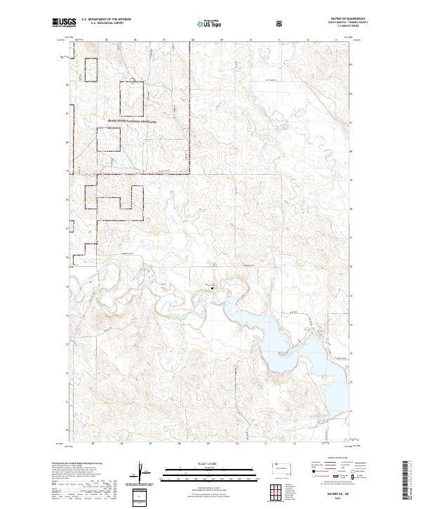
2021 Map of Haynes SE
USGS Topo · Published 2021About this map
Grand River National Grassland dominates the northern landscape of this Perkins County region, where the open prairie is bisected by a network of rural routes such as White Butte Rd and Pasture 5B Rd. The topography is defined by the winding course of the North Fork Grand River, which gathers into a significant body of water in the southern half of the quadrangle. Along its northern banks, the Scholass Cem serves as a quiet marker of early settlement history in this remote section of South Dakota.
Find a feature on this map
21 named features on this map. Tap any name to fly to it.
Don’t see what you’re looking for? This feature index may not catch every label — zoom into the map to look around manually.
Map Details
Editions of this 2021 Haynes SE Map
This is the sole edition of this map. No revisions or reprints were ever made.
Other maps of this area

1954 · Lemmon
USGS Topo · 1:250,000

1957 · Lemmon
USGS Topo · 1:250,000

1974 · White Butte
USGS Topo · 1:24,000

1974 · Lemmon
USGS Topo · 1:24,000

1974 · Haynes
USGS Topo · 1:24,000

1983 · Haynes SE
USGS Topo · 1:24,000

1983 · Bison NE
USGS Topo · 1:24,000

1983 · Meadow NW
USGS Topo · 1:24,000

1983 · Bison NW
USGS Topo · 1:24,000
1983 · Sommerville
USGS Topo · 1:24,000