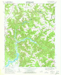
1968 Map of Haynesville
USGS Topo · Published 1972About this map
Totuskey Creek defines the landscape of this 1968 study, winding south from Haynesville through the heart of Richmond County. The map reveals a rural Virginia county seat at Warsaw, balanced by smaller communities like Emmerton and Farnham. Along the northern edge, a series of millponds such as Gardys Millpond and Garlands Millpond mark the historical water-powered industry of the Northern Neck.
Find a feature on this map
49 named features on this map. Tap any name to fly to it.
Don’t see what you’re looking for? This feature index may not catch every label — zoom into the map to look around manually.
Map Details
Editions of this 1968 Haynesville Map
Other maps of this area

1892 · Piney Point
USGS Topo · 1:62,500

1892 · Montross
USGS Topo · 1:62,500

1894 · Piney Point
USGS Topo · 1:62,500

1895 · Nomini
USGS Topo · 1:125,000

1895 · Piney Point
USGS Topo · 1:62,500

1895 · Montross
USGS Topo · 1:62,500

1898 · Nomini
USGS Topo · 1:125,000

1901 · Piney Point
USGS Topo · 1:62,500

1917 · Morattico
USGS Topo · 1:62,500

1918 · Tappahannock
USGS Topo · 1:62,500