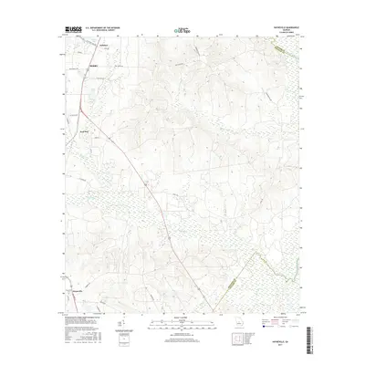
2017 Map of Hayneville
USGS Topo · Published 2017About this map
Perry and Kathleen sit at the northern edge of this Houston County landscape, where the terrain begins its descent toward the swampy bottomlands of the Ocmulgee River. The area is defined by a dense network of tributaries including Mossy Creek, Big Indian Cr, and Big Grocery Cr, which weave through the agricultural and wooded tracts. To the south, the settlement of Hayneville is marked by the Hayneville Cem near the intersection of Wimberly Rd and Main St.
Find a feature on this map
35 named features on this map. Tap any name to fly to it.
Don’t see what you’re looking for? This feature index may not catch every label — zoom into the map to look around manually.
Map Details
Editions of this 2017 Hayneville Map
This is the sole edition of this map. No revisions or reprints were ever made.
Other maps of this area

1956 · Cochran
USGS Topo · 1:62,500

1956 · Perry
USGS Topo · 1:62,500

1956 · Warner Robins
USGS Topo · 1:62,500

1956 · Jeffersonville
USGS Topo · 1:62,500

1957 · Macon
USGS Topo · 1:250,000

1958 · Macon
USGS Topo · 1:250,000

1964 · Macon
USGS Topo · 1:250,000

1973 · Hayneville
USGS Topo · 1:24,000

1973 · Klondike
USGS Topo · 1:24,000
1973 · Unadilla
USGS Topo · 1:24,000