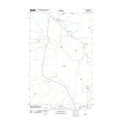
2011 Map of Hays
USGS Topo · Published 2011About this map
Hays and the nearby community of Pine Grove serve as the primary human settlements in this Montana landscape, where the foothills meet the rising elevations of the Little Rocky Mountains. The map highlights a significant cultural and genealogical record through its well-marked burial sites, including Saint Pauls Mission Cemetery, Hays Cemetery, and McConnell Cemetery. These locations, along with the Fort Belknap Vol Fire Dept Hays, reflect the community infrastructure centered around the intersection of Gros Ventre Ave and Hays School Rd.
Find a feature on this map
37 named features on this map. Tap any name to fly to it.
Don’t see what you’re looking for? This feature index may not catch every label — zoom into the map to look around manually.
Map Details
Editions of this 2011 Hays Map
This is the sole edition of this map. No revisions or reprints were ever made.
Other maps of this area

1943 · Landusky
USGS Topo · 1:125,000

1953 · Havre
USGS Topo · 1:250,000

1954 · Lewistown
USGS Topo · 1:250,000

1957 · Havre
USGS Topo · 1:250,000

1958 · Havre
USGS Topo · 1:250,000

1959 · Lewistown
USGS Topo · 1:250,000

1971 · Crazyman Coulee
USGS Topo · 1:24,000

1971 · Hays
USGS Topo · 1:24,000

1971 · Hays SE
USGS Topo · 1:24,000
1971 · Stiffarm Coulee
USGS Topo · 1:24,000