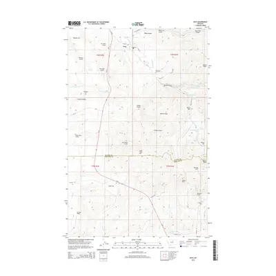
2014 Map of Hays
USGS Topo · Published 2014About this map
Hays and Pine Grove serve as the primary focal points of this 2014 survey, which covers a section of the border between Blaine Co and Phillips Co. The landscape is defined by its series of coulees and flats, including Warneke Flat, Otter Robe Coulee, and Four Bear Coulee. Significant landmarks such as Eagle Child Mtn, Mission Peak, and Indian Peak provide substantial elevation changes across the quadrangle. For those researching local history, the map identifies several distinct burial sites including Hays Cem, Saint Pauls Mission Cem, and the Landusky Cem to the south. The drainage network is complex, with the Little Peoples Cr system and Squaw Cr carving through the terrain. Transportation in the area relies on MT-66 and a network of local routes like Williams Rd and Landusky Rd, connecting the scattered settlements and natural features like Wilson Park.
Find a feature on this map
60 named features on this map. Tap any name to fly to it.
Don’t see what you’re looking for? This feature index may not catch every label — zoom into the map to look around manually.
Map Details
Editions of this 2014 Hays Map
This is the sole edition of this map. No revisions or reprints were ever made.
Other maps of this area

1943 · Landusky
USGS Topo · 1:125,000

1953 · Havre
USGS Topo · 1:250,000

1954 · Lewistown
USGS Topo · 1:250,000

1957 · Havre
USGS Topo · 1:250,000

1958 · Havre
USGS Topo · 1:250,000

1959 · Lewistown
USGS Topo · 1:250,000

1971 · Crazyman Coulee
USGS Topo · 1:24,000

1971 · Hays
USGS Topo · 1:24,000

1971 · Hays SE
USGS Topo · 1:24,000
1971 · Stiffarm Coulee
USGS Topo · 1:24,000