2024 Map of Hays
USGS Topo · Published 2024About this map
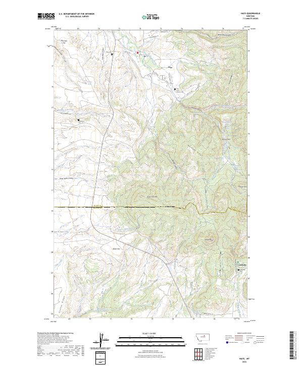
The settlement of Hays and the southern village of Landusky anchor this survey of the Little Rocky Mountains near the border of Blaine and Phillips counties. Significant for local family researchers, the landscape is dotted with ancestral sites including the Saint Pauls Mission Cem, Hays Cem, and McConnell Cem. The terrain is defined by deep drainages and ridges, such as Mission Canyon and Eagle Child Mtn, which separate the various branches of Little Peoples Creek. To the south, Abbot Flat and Montana Gulch indicate the transition from high mountain ridges to more level plains. The inclusion of several named springs and coulees, including Warneke Spring and Four Bear Coulee, provides a detailed view of the water sources that have historically supported ranching and habitation in this part of Montana.
Find a feature on this map
57 named features on this map. Tap any name to fly to it.
Don’t see what you’re looking for? This feature index may not catch every label — zoom into the map to look around manually.
Map Details
Editions of this 2024 Hays Map
This is the sole edition of this map. No revisions or reprints were ever made.