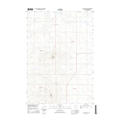
2015 Map of Haystack Butte
USGS Topo · Published 2015About this map
Haystack Butte and Castle Rock Butte dominate the landscape of this high plains section of Butte County. The terrain is defined by a network of seasonal watercourses and drainage basins, including the S Fork Moreau River which winds across the northern reaches, joined by Hay Cr. Further south, the drainage of Bull Cr and Battle Cr illustrates the erosional forces that have shaped the distinctive buttes and ridges. Human presence is marked primarily by section-line tracks and rural routes such as Burke Rd and Southfork Rd, facilitating movement through this grazing country. The map captures the vast, open character of the South Dakota rangeland, where topographic prominence like Castle Rock Rd serves as a critical navigational landmark for those traversing the sparsely populated township lines of t13n r5e and t12n r6e.
Find a feature on this map
14 named features on this map. Tap any name to fly to it.
Don’t see what you’re looking for? This feature index may not catch every label — zoom into the map to look around manually.
Map Details
Editions of this 2015 Haystack Butte Map
This is the sole edition of this map. No revisions or reprints were ever made.
Other maps of this area

1906 · Two Top
USGS Topo · 1:62,500

1907 · Belle Fourche
USGS Topo · 1:125,000

1913 · Newell
USGS Topo · 1:125,000

1935 · Hoover
USGS Topo · 1:125,000

1935 · Harding
USGS Topo · 1:125,000

1953 · Rapid City
USGS Topo · 1:250,000

1954 · Lemmon
USGS Topo · 1:250,000

1957 · Lemmon
USGS Topo · 1:250,000

1957 · Rapid City
USGS Topo · 1:250,000
1965 · Two Top Butte East
USGS Topo · 1:24,000