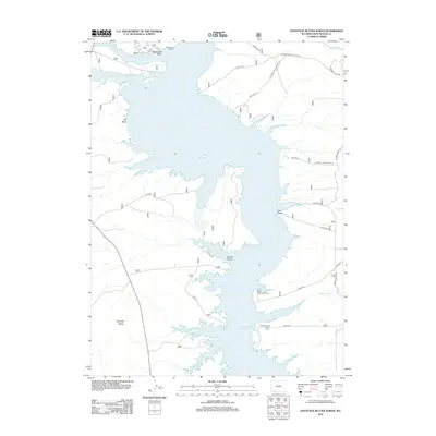
2012 Map of Haystack Buttes North
USGS Topo · Published 2012About this map
Flaming Gorge Reservoir dominates this high-desert landscape in Sweetwater County, where the Green River valley was transformed by mid-century water management. The 2012 survey illustrates the irregular shoreline of the reservoir, highlighting submerged historical features like Buckboard Crossing and the persistent drainage of Buckboard Wash. Inland from the eastern shore, the map details the rugged topography of Lowe Canyon and Squaw Hollow, while the western side is defined by the prominent Haystack Buttes. Local history is anchored at Brinegar Ranch, located near the reservoir's edge south of the Upper Marsh Creek Boat Ramp. The intricate network of forest service roads, including US Forest Service Road 19 and Flaming Gorge Rd, reveals how this remote terrain is accessed for recreation and ranching.
Find a feature on this map
27 named features on this map. Tap any name to fly to it.
Don’t see what you’re looking for? This feature index may not catch every label — zoom into the map to look around manually.
Map Details
Editions of this 2012 Haystack Buttes North Map
This is the sole edition of this map. No revisions or reprints were ever made.
Other maps of this area

1954 · Rock Springs
USGS Topo · 1:250,000

1957 · Currant Creek Ranch
USGS Topo · 1:62,500

1957 · Mc Kinnon Junction
USGS Topo · 1:62,500

1957 · Firehole Basin
USGS Topo · 1:62,500

1958 · Rock Springs
USGS Topo · 1:250,000

1962 · Rock Springs
USGS Topo · 1:250,000

1966 · Firehole Basin
USGS Topo · 1:62,500

1966 · Mc Kinnon Junction
USGS Topo · 1:62,500

1966 · Buckboard Crossing
USGS Topo · 1:62,500

1966 · Currant Creek Ranch
USGS Topo · 1:62,500