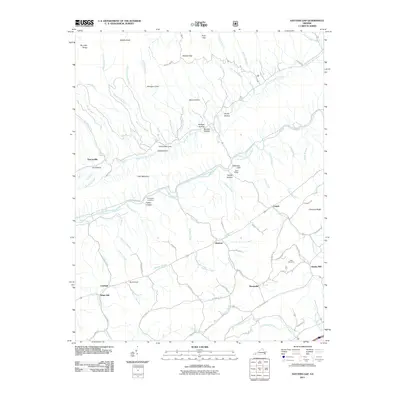
2011 Map of Hayters Gap
USGS Topo · Published 2011About this map
Little Mountain and Brumley Ridge define the steep topography of this Washington County landscape, where the North Fork Holston River carves a path through the valley. Small settlements and historical industrial sites like White Mill and Giesley Mill are situated near the waterways, reflecting the early importance of water power in this region. The area is marked by numerous deep hollows and coves, including Whiterock Cove and Edington Cove, which historically provided sheltered pockets for mountain farming and timbering.
Find a feature on this map
82 named features on this map. Tap any name to fly to it.
Don’t see what you’re looking for? This feature index may not catch every label — zoom into the map to look around manually.
Map Details
Editions of this 2011 Hayters Gap Map
This is the sole edition of this map. No revisions or reprints were ever made.
Other maps of this area

1891 · Abingdon
USGS Topo · 1:125,000

1894 · Abingdon
USGS Topo · 1:125,000

1897 · Bristol
USGS Topo · 1:125,000

1902 · Bristol
USGS Topo · 1:125,000

1909 · Abingdon
USGS Topo · 1:96,000

1911 · Abingdon
USGS Topo · 1:125,000

1918 · Carterton
USGS Topo · 1:62,500
1934 · Lebanon
USGS Topo · 1:24,000

1934 · Brumley
USGS Topo · 1:24,000

1934 · Wyndale
USGS Topo · 1:24,000