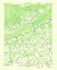
1935 Map of Hayters Gap
USGS Topo · Published 1935About this map
The North Fork Holston River carves a central path through this corner of Southwest Virginia, separating the prominent heights of Clinch Mountain and Little Mountain from the fertile valley floors. The landscape is defined by its ridge-and-valley structure, with Poor Valley and Rich Valley providing the primary corridors for early 20th-century settlement and transit. These agricultural pockets supported small, tight-knit communities such as Glenford, Lindell, and Shortsville, each anchored by essential local institutions like the Maiden Falls Sch and Wesley Chapel.
Find a feature on this map
61 named features on this map. Tap any name to fly to it.
Don’t see what you’re looking for? This feature index may not catch every label — zoom into the map to look around manually.
Map Details
Editions of this 1935 Hayters Gap Map
This is the sole edition of this map. No revisions or reprints were ever made.
Other maps of this area

1891 · Abingdon
USGS Topo · 1:125,000

1894 · Abingdon
USGS Topo · 1:125,000

1897 · Bristol
USGS Topo · 1:125,000

1902 · Bristol
USGS Topo · 1:125,000

1909 · Abingdon
USGS Topo · 1:96,000

1911 · Abingdon
USGS Topo · 1:125,000

1918 · Carterton
USGS Topo · 1:62,500
1934 · Lebanon
USGS Topo · 1:24,000

1934 · Brumley
USGS Topo · 1:24,000

1934 · Wyndale
USGS Topo · 1:24,000