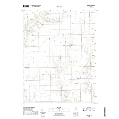
2018 Map of Hazel Dell
USGS Topo · Published 2018About this map
Hazel Dell and the smaller settlement of Advance serve as the primary focal points of this Illinois landscape, which spans the junctions of Cumberland, Clark, and Jasper Counties. The terrain is defined by a dense network of winding waterways including Range Cr, Chivler Cr, and E Crooked Cr, which cut through the agricultural grid. This 2018 survey reveals a high concentration of small family and community burial grounds, such as the Swick Family Cem, Debord Cem, and Paul Cem, reflecting generations of rural settlement. Religious life is anchored by the Church of Christ Cem and Church of God Cem located near the Hazel Dell townsite. The map illustrates the persistence of the Public Land Survey System, with township and range lines like t9n r10e and t8n r11e dictating the placement of county roads that connect these isolated hamlets and farmsteads.
Find a feature on this map
50 named features on this map. Tap any name to fly to it.
Don’t see what you’re looking for? This feature index may not catch every label — zoom into the map to look around manually.
Map Details
Editions of this 2018 Hazel Dell Map
This is the sole edition of this map. No revisions or reprints were ever made.
Other maps of this area

1933 · Toledo
USGS Topo · 1:62,500

1936 · Casey
USGS Topo · 1:48,000

1938 · Toledo
USGS Topo · 1:62,500

1940 · Greenup
USGS Topo · 1:62,500

1942 · Casey
USGS Topo · 1:62,500

1943 · Greenup
USGS Topo · 1:62,500

1943 · Casey
USGS Topo · 1:62,500

1953 · Indianapolis
USGS Topo · 1:250,000

1956 · Indianapolis
USGS Topo · 1:250,000

1956 · Annapolis
USGS Topo · 1:62,500