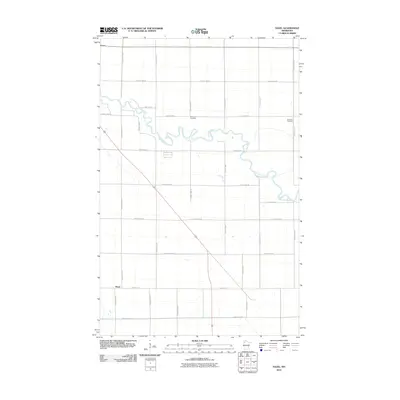
2010 Map of Hazel
USGS Topo · Published 2010About this map
Red Lake River meanders sharply through this Pennington County landscape, defining the topography between the small settlement of Hazel and the surrounding agricultural sections. The river's winding course is traced by Red Lake Dr, while a rigid grid of rural roads, including County Hwy-82 and County Hwy-61, organizes the territory for local residents and farmers. Genealogists will find two significant burial sites documented here: Emanuel Cemetery, situated near the center of the quadrangle, and Bethania Cemetery, located on the eastern edge along County Hwy-85. The map reflects a quiet rural era in northwest Minnesota, where the community is anchored by the modest residential streets of Hazel, such as Center St E, and a network of county highways that connect these remote homesteads.
Find a feature on this map
25 named features on this map. Tap any name to fly to it.
Don’t see what you’re looking for? This feature index may not catch every label — zoom into the map to look around manually.
Map Details
Editions of this 2010 Hazel Map
This is the sole edition of this map. No revisions or reprints were ever made.
Other maps of this area

1918 · Terrebonne
USGS Topo · 1:62,500

1919 · Grit
USGS Topo · 1:62,500

1943 · Thief River Falls
USGS Topo · 1:62,500

1952 · Grand Forks
USGS Topo · 1:250,000

1952 · Thief River Falls
USGS Topo · 1:250,000

1954 · Bemidji
USGS Topo · 1:250,000

1954 · Roseau
USGS Topo · 1:250,000

1956 · Thief River Falls
USGS Topo · 1:250,000

1956 · Grand Forks
USGS Topo · 1:250,000

1957 · Roseau
USGS Topo · 1:250,000